 The Concept: Top illustrators respond to contemporary congressional districts twisted into torturous shapes by partisan map-makers.
Background: After learning that modern gerrymandering is probably more pervasive, sophisticated, and damaging than ever, I was disappointed at the visual presentation of these grotesque districts in most media reports on the subject.
After all, early 19th century illustrator Elkanah Tisdale’s “Gerrymander,” representing a politically twisted Massachusetts state senate district is one of the most famous information-illustrations of all time. I suggested that someone should round up some great illustrators and turn them loose on today’s most-gerrymandered districts. And since nobody took me up on that, eventually I did it.
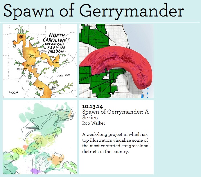
The Project: Published on Design Observer over the course of a week in October 2014 (shortly before a mid-term election), the series presented graphic visualizations of six gerrymandered U.S. Congressional districts, created by six dynamite illustrators:Joe Alterio, Steve Brodner, Lisa Congdon, Jennifer Daniel, Oliver Munday, and Leif Parsons. More below.
Press: Creators Project, Studio 360 Sideshow, Creative States, BoingBoing.
Special Thanks: The project was made possible in part by a grant from The Awesome Foundation’s Awesome Without Borders chapter.
The series is introduced here. Explore all the entries here.
Scroll down for more. Click on the image or headline for the Design Observer post with additional information about each district and the illustration process. As you’ll see, Joe Alterio’s piece is a GIF, and as you will not see, Steve Brodner actually made three distinct illustrations. There’s one below, but to see them all visit the D.O. post, which also includes my concluding remarks on the series. An excerpt:
It happens that this district is a product of what Real Clear Politics mused might be “the gerrymander of the decade.” But I think Brodner’s response speaks not just to one district, but to this project’s broader theme: More than 200 years after a famous political illustration drove home the absurdity and injustice mapmaking designed for politicians rather than voters, gerrymandering is alive and well. Maybe if we see that more clearly, we’ll do something about it.
That’s been our goal this week. Thanks for taking a look.
I hope you’ve been bothered by what you’ve seen.
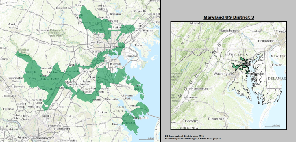
Joe Alterio’s Maryland 3rd:

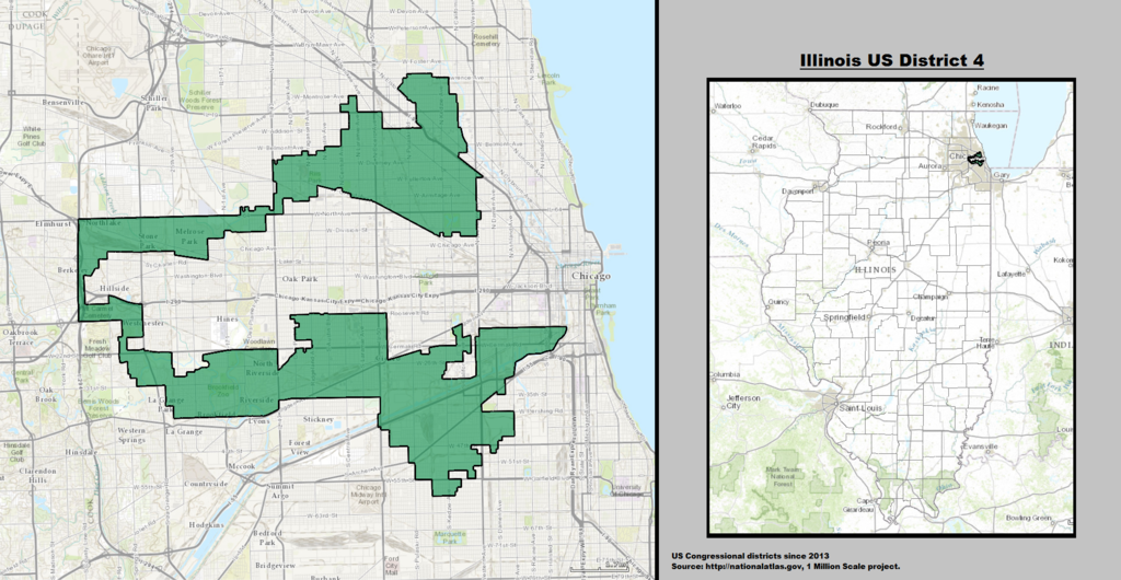
Leif Parsons’ Illinois 4th:

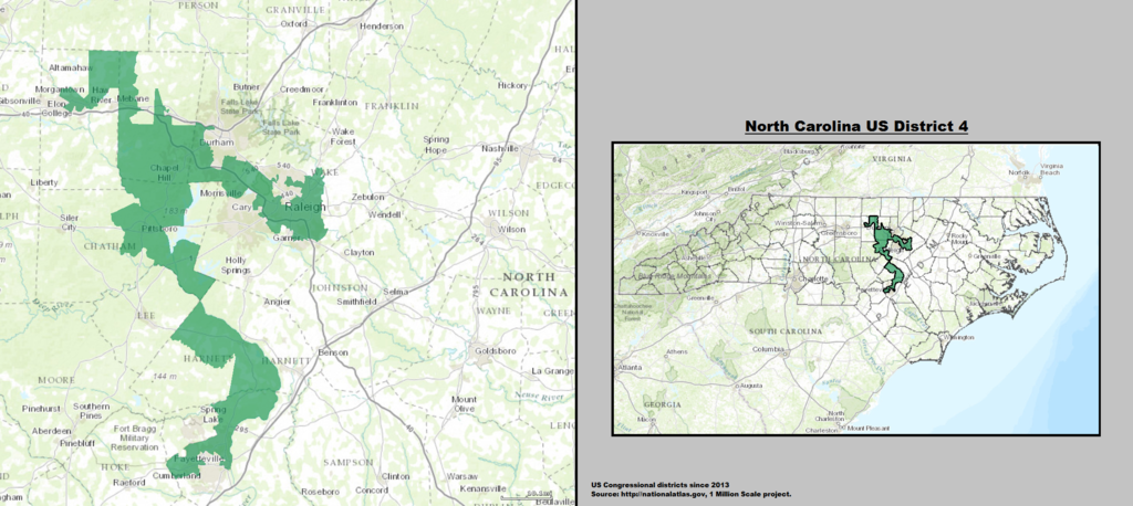
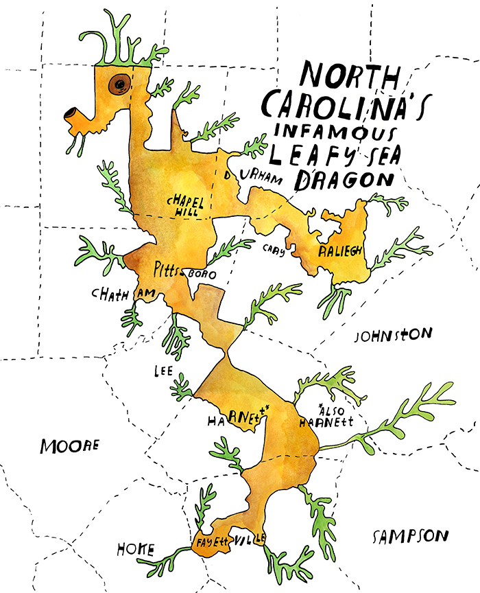
Lisa Congdon’s North Carolina 4th:
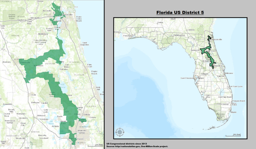
Oliver Munday’s Florida 5th:
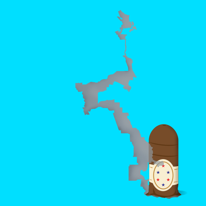
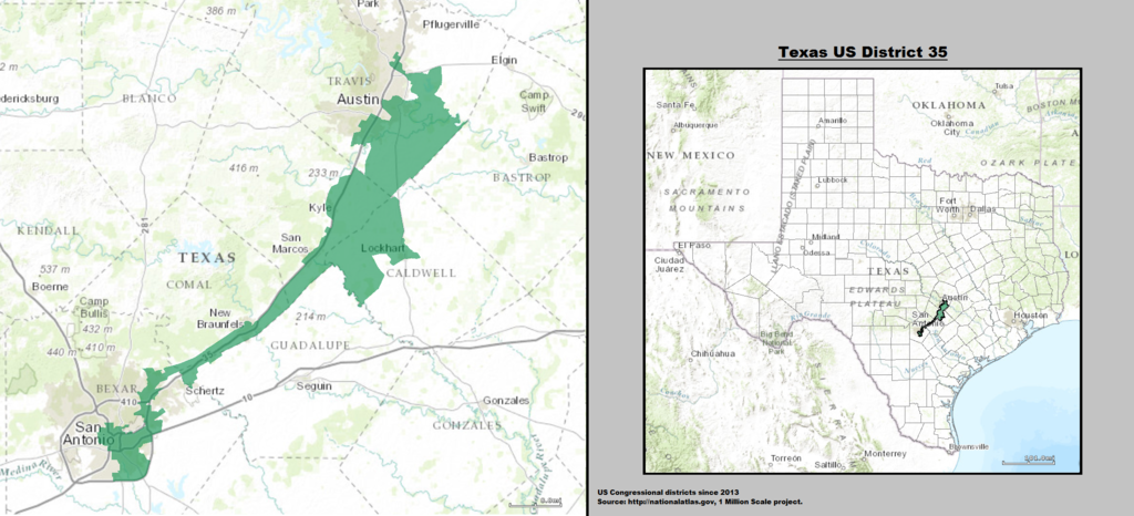
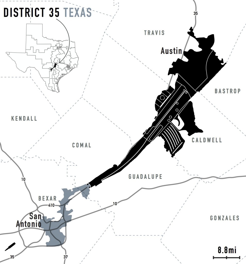
Jennifer Daniel’s Texas 35th:
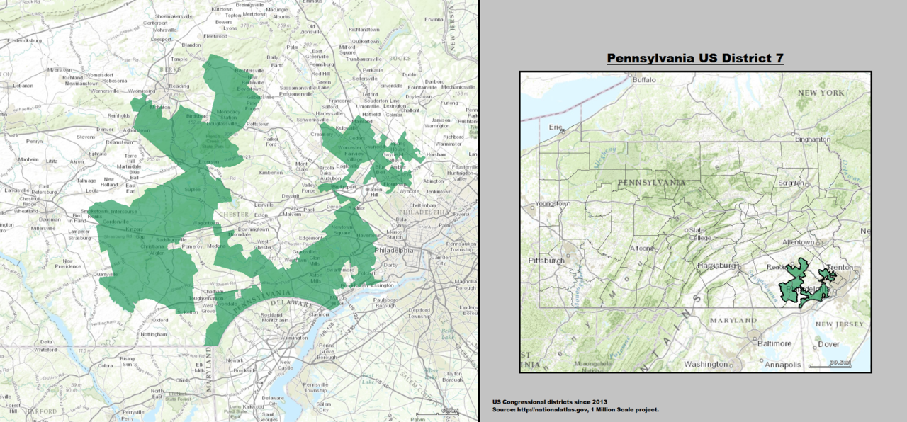
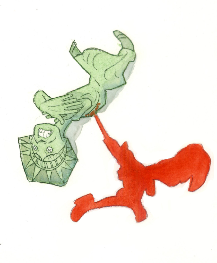
Steve Brodner’s Pennsylvania 7th: